Your cart is currently empty!
Fixed Fee Services Word
Choose from our selection of fixed rate service packages offering quantitative risk analysis and environmental risk intelligence. Our seamless process identifies the issue, clearly conveys that information through beautiful visual data and achieves optimized results.Upon purchase, we’ll reach out to discuss your specific data support and risk-based analysis needs. From there, simply provide us with the dataset for analysis and we’ll provide detailed outputs ready made for reporting.
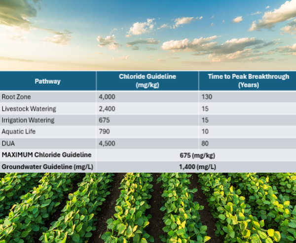
Subsoil Salinity Tool applicability review
$399.00*This is only available with the purchase of Salt Contamination Analysis.
Groundwater Spatiotemporal Analysis
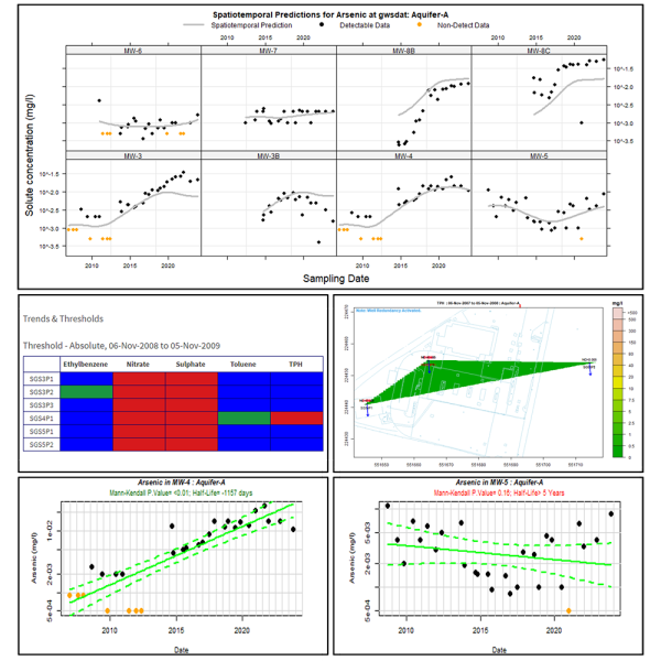
$1,499.00Utilizing the EsDAT and GWSDAT software packages we will run spatiotemporal analysis to provide visualization and interpretation of your groundwater data. In addition, we will report on trends (Mann-Kendall), redundancy analysis and provide meaningful insight as it relates to regulatory standards in the jurisdiction of choice.
Salt Contamination Analysis
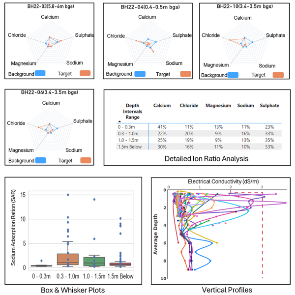
$999.00A detailed salt contamination visualization and analysis inclusive of background salinity assessment, saturation percent graphing, vertical profiling and ion ratio analysis. Requires client provision of borehole logs and detailed salinity (laboratory results).
2D/3D Drill Hole Visualization
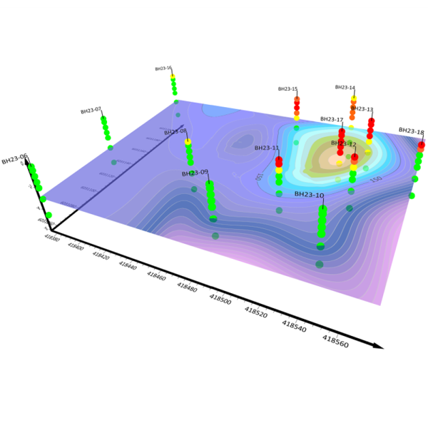
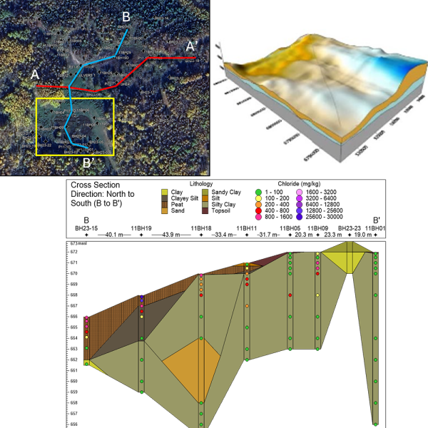
$999.00A 2D/3D model of the site drill hole locations (boreholes) with sampling depth intervals and visual indication of contaminant magnitude. Colouration scheme is customizable and can be selected as magnitude of applied guideline exceedance.
Cross-Sections
$599.00We provide three figures minimum: A plot map of the borehole orientation and selection points, cross-sections indicating site lithology, groundwater, ground elevation and contaminant concentration (as requested) from West to East and North to South. We require provision of borehole logs. Relative datum can be ascertained with or without survey data from open source.
